Carrito
No hay más artículos en su carrito


|
|

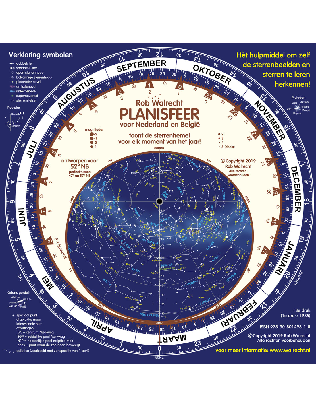
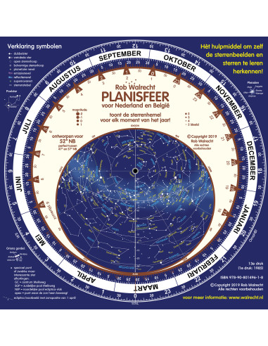
Completely redesigned standard planisphere for 52° N in Dutch, highly accurate for any area between 47° and 57° N and specifically designed for the Netherlands and Belgium. It's the only planisphere designed for a specific longitude: 5° E, meaning it never needs to be adjusted to the observation site in the Benelux.
Includes manual and tips!
|
|
|

|
|

|
|

|
|

|
|
The planisphere is the ultimate tool for exploring the night sky, with all its constellations and bright stars. A planisphere consists of a circular map of the sky, with the celestial pole at its center. This star chart shows all the stars, constellations, and objects such as nebulae, visible in a given area. However, the night sky isn't always the same: stars rise and set, and in summer you see a different part of the sky than in autumn, winter, or spring. Therefore, the planisphere contains a second disk on top of the star chart. This disk has a transparent opening that shows which part of the sky is actually visible at any given moment. And that moment is very easy to set, with the date and time. Highly recommended!
Specifications
Planisphere for 52° Northern latitude in Dutch language, very accurate for every location between latitudes 47° and 57° North, which makes it excellent for The Netherlands and Belgium.
This is a 25cm square planisphere, with a manual and a lots of interesting tips in Dutch in the two pages and on the backside.
Can be used in: Northern part of US, South of Canada, Mid of Europa, Central Asia.